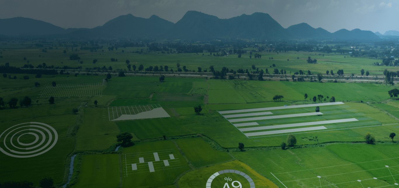
AreaMapping
Capture geographic information and visuals, quick tree counting, gain plant nutrition insights, and locate sick crops.
Aria Mapping Features
Explore our services
Capture Layers
With our drone and multispectral camera, capture data on Digital Surface Model (DSM), Digital Terrain Model (DTM), Digital Elevation Model (DEM), RGB Mosaic Map, NDVI, Canopy Height Model, and many more. Take action to improve farmland conditions and increase harvest quantity and quality.
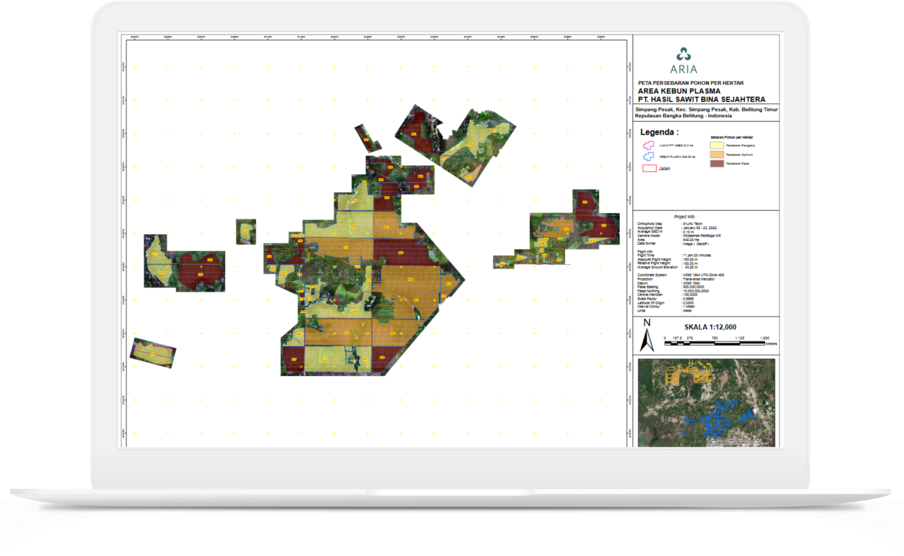
Tree Counting & Mapping
Gain insights through plant health mapping and early disease detection.
Up to 1200 Ha
Our drones can cover up to 1200 Ha with a flight time of 110 minutes.
Fast Airborne
No pre-flight calibrations necessary. Get airborne in under 2 minutes.
Locate & Treat Plants
Detect nutrient deficient plants and take action to prevent crop failure.
Crystal Clear
We provide quality service with high-resolution cameras up to 61MP.
LIDAR Technology
The latest LIDAR technology to gain insights on plant health and vigor.
Drone Mapping Output Example
Red green blue (Mosaic Map)
Normalized difference vegetation index (NDVI)
Digital surface model (DSM)
Digital terrain model (DTM)
Tree Density Model Report